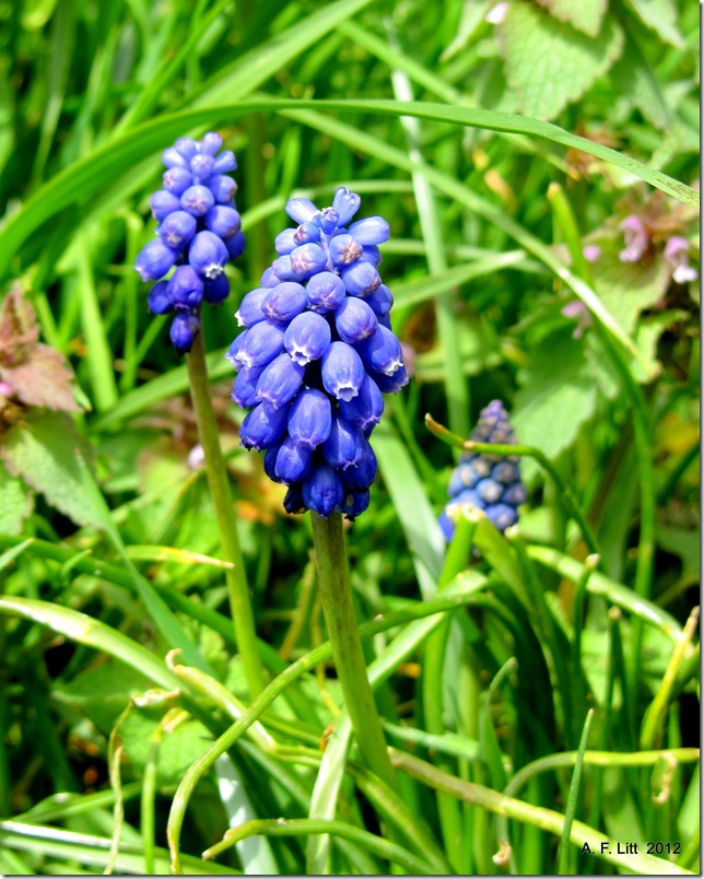
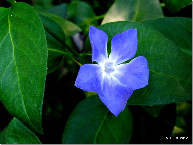
I think both of these photos have been up as Photo of the Day back during the early days of that on-going project, so I am not posting them as Photos of the day for today...
Just a couple of quick notes on this National Recreation Area. It was designated by Congress in 1990 and is managed by the United States Forest Service (Six Rivers National Forest). We camped there between the Oregon Caves and the Redwoods in 2012, but did very little exploring in the Recreation Area itself.
Wikipedia says that this "area is considered one of the best fishing regions in the U.S."
I am going to try to get this going again. It may be a lot (A LOT) of photos from the Historic Columbia River Highway to start.
What was killing me the last time out was trying to tack on a decent blog post for each photo. I would like to do that from time to time, but to make this work, it can't be more than a few words most days.
Heading back to the photos from our August wanderings for a bit. Again, don’t have a ton of time today, so not a lot of writing. Spent this day wandering through the old Minutemen NHS sites and Badlands National Park. Oh, and Wall Drug, of course…
This was near the end of trip. From here we turned south to Nebraska before jamming home, in just a couple days, mostly following the old Oregon Trail route. Plenty more pictures to follow, though. It was a busy few days.
There were a lot of nasty biting flies along the Rim this day. This was about the only bug I was happy to see along this drive and at these viewpoints.
We know it has been a long wait, but 10.10.10 DVD's are finally here and shipping! From now until October 24th, you can buy the DVD at the pre-sale price of $14.99. We have beautiful posters and photo prints for sale as well.
Your purchase will help keep One Day on Earth alive for a third collaboration. In order to launch 12/12/12, we must reach our funding goal of $50,000 by October 24. This is just a fraction of the production cost, but will ensure that we will have enough producers on staff and technology updates in place.
Please consider purchasing a DVD and making a donation to help keep One Day on Earth alive for another year!
The 11/11/11 movie that I submitted some clips for is still in production. Here is my edited submission for the geotagged archive.
Today is the first time I’ve watched it in awhile. Put a lot of work into it and, unfortunately, I still have a hard time listening to that poor Walkabouts song. It used to be one of my favorites. But I like it. I am happy with what I was able to put together considering the limitations of gear I struggled with at the time, from camera to computer.
This year, for 12/12/12, I’ll have a better camera, more experience working with video, and I hope to focus more on film than on stills. Also, I hope to have more of a topic to focus on, rather than some vague thoughts about transportation, Veterans’ Day, early Christmas decorations, poverty, Occupation, and fall colors. I like the way those themes weave through the video, it feels like a nice little journey to me, but I’d like more of a specific topic this year.
I’ll probably only have a few days to prepare after NaNoWriMo for this, but it is a project I am looking forward to.
“One Day on Earth” is the culmination of a film and social-networking project started four years ago by Kyle Ruddick and Brandon Litman, two graduates of the University of Southern California. Mr. Ruddick has said he came up with the idea of documenting every corner of the world on a single day after attending a world music festival and watching various sonic styles mingle.
As Mr. Ruddick finished the feature-length movie, compiled from over 3,000 hours of video, in California, Mr. Litman worked from New York to secure financial and logistics support from charities and humanitarian organizations. Over 60 such partners signed on.
The 105-minute film includes rare footage from places where American filmmakers aren't exactly welcome--including North Korea, where a military parade was secretly shot. "We had someone who basically shot covert with a DSLR camera that was rolling video," Ruddick told Yahoo News. "It was harrowing to watch--you never want someone to put themselves in danger, or get hurt."
Footage from South Sudan, North Africa and Tunisia--which in 2010 was on the brink of igniting the Arab spring--was just as difficult to obtain. The pair also partnered with more than 60 NGOs, including Oxfam and Human Rights Watch--"people who know the logistics on the ground," Litman said.
If this all sounds familiar, last year’s Ridley Scott-produced documentary Life in a Day pulled off a similar feat by gathering video shot by YouTube users. But One Day on Earth, the brainchild of first-time filmmakers Kyle Ruddick (director) and Brandon Litman (executive producer), was initially set in motion four years ago. And unlike Life in a Day, which was backed by YouTube and Scott Free Productions and was distributed by National Geographic Films, Ruddick and Litman turned to nonprofit partners including the United Nations and World Wildlife Fund.
I’m a big fan of Life in a Day, but I see no reason why we can’t have two of these crowdsourcing “Earth in a single day” films. And if this Beirut-scored trailer is any indication, One Day on Earth seems to have the goods.
Not that I have returned there, just that I didn’t write much in the first place and this walk (not so much a hike) has become something of a benchmark… Though not, necessarily, in a good way.
First, let me say, the fact that this park exists is awesome. We need these sorts of green spaces and too many of our buttes are covered with houses, not trees or meadows.
Let me also say, this butte and its trails must be awesome for those who live near by. We hit our stretch of the Springwater Trail at least once a week, most weeks. Dog walks, transportation, just getting outside… We have several such places within walking distance or a quick drive, including Powell Butte. If Talbert was this close, I am sure I would spend a lot of time on it.
However, as a destination… Well, I am pretty spoiled living right down the road from Powell Butte, which is, quite simply, spectacular.
Since taking this hike a little over a year ago, Mt. Talbert has become the standard of dull, viewless walks through humdrum second or even third growth woods. As I am putting together some new posts on some other hikes, walks, and parks this fall, I realized that, before I start referencing Talbert, perhaps I should revise this old post to reflect what I am writing about these days.
So, in June 2011 my son and I made a quick loop over the Summit Trail from the Mather Road Entrance. It was pleasant and close to home. Being the middle of the summer, there were no views, though some may be visible through the trees in the winter.
Actually, I remember thinking that this would be a much better winter hike than a summer hike, not only because of the faint possibility of a view or two, but mostly because it is close enough to home that I could sneak a decent little walk in before the early sunset shuts my preferred trails down and it, obviously, will not be buried under feet of snow 99.99999% of the winter.
In the summer, this is about the best I can say for it… It was fun as a little hill climbing workout but, by June, I was in decent enough shape that I was barely winded by the time we reached the 750 foot summit, though for my son it was pretty tiring (see the photos in the original post below). I tend to have a collecting streak in me, so getting to the top was worth an afternoon and exploring a new park was fun. As I told my son, at the very least, it was worth it so we can say, “Been to the top of that one.”
But, bottom line… All things considered, I’d rather be on Powell Butte. There is nothing terrible about the walk up Talbert. Just nothing terribly exciting, either. Perhaps I am spoiled.
I grew up spending my winter afternoons and summer days wandering through second growth woods just like these up near Seattle. At least the woods of my youth were filled with little hidden lakes and other secret spots of interest (interesting, at least, to a pre-teen boy). There may be some great secret spots on Talbert, but we didn’t find them on the first trip and my interests have, alas, probably grown more jaded over the years.
One of the problems (what a problem!) of living in the northwest is that we are very spoiled. It takes me about ten minutes longer to drive to the Gorge than it does for me to drive to Talbert. And far less time to drive to Powell Butte.
But, I will say this to wrap up… The meadows on Powell are spectacular, but they aren’t natural. They are an artificial environment. Rocky Butte and Mt. Tabor? They are not wild places, ur… Well, they ain’t wild in the environmental sense. At least we have one butte in the area that is relatively untouched, at least for the last 100 years or so, and that will remain undeveloped for the future.
On Talbert, we are not talking about a pocket of a park surrounded by a desert of housing developments, or graded meadows and abandoned orchards, we are talking about an entire butte slowly reverting to its natural state, as it was for ages before this area was developed. And that is very cool. While it might not make for the most interesting of walks or hikes, the Park itself is a real treasure.
Especially considering how Powell Butte is currently being torn up by the water bureau and how most of Jenne Butte’s summit looks doomed to development as soon as the housing crisis resolves itself, having an entire butte that will remain untouched forever (hopefully) is a real win for Metro and for all of us who appreciate such things..
So forgive me if I am a little hard on the place, I really do appreciate Mount Talbert. I am glad it is there and I am sure that I will spend some more time on it this winter. But, for the most part, it is like a museum piece. It comforts me to know that it is there, safe and preserved, but if I am looking for fun times and exciting adventures, I’ll probably head elsewhere…
A Cave?
Just one final note… Glancing through the comments on one of the articles below, I discovered that there may be a cave on Talbert. Now that is a secret cool spot that I am not too jaded to get excited about.
According to the Development Master Plan from 2000:
Long time neighbors of Mt. Talbert have described a natural cave located in the northwest quadrant of the study area. This natural feature is currently on private property and has not been explored by NCPRD staff or the consultant team. It has been described as a small cavern (inundated with poison oak) no more than 100 feet long with limited headroom. Caves are often associated with early Native American shelters and have been found to have archeological significance. This cave may also be used by bats. If this feature is to become part of the publicly owned park, a thorough analysis and record will be required. Until a comprehensive study is completed, any disturbance to this area should be avoided. (39)
A large chunk of land in the northwest quadrant was added to the park after the report was written. However, I am not sure if this is where the cave was rumored to be or not. Also, I have not been able to find any other references to this cave, so perhaps, it was just a rumor… Or is it waiting to be rediscovered?
I wrote recently that, wandering through the lava flows and buttes in Newberry National Volcanic Monument, I couldn’t help but to get the feeling that the landscape looked a lot like what my neighborhood might have looked like at one point in the distant past. Towards the end of the Lava Cast Forest trail, I found myself looking across a small valley that reminded me of home, with a small butte across from me that looked remarkably like Grant Butte in Gresham, surrounded not by flat wetlands, but by a flat, geologically recent lava flow.
Out on that lava flow, I started wondering what hidden volcanic features we might have in our area, including lava tubes. While any evidence of lava is long buried around here, our volcanoes preceding the Missoula floods by a fair bit, it still doesn’t mean that there might not be some lava tubes buried deep down beneath our feet.
This is an ancient tube and no surviving caves have been discovered. The tube was discovered during the construction of the hospital, and it was filled with rubble. Further research turned up five collapse depressions and no access to any possible surviving caves.
Still, if there is one, might not there be another around here some place? I actually have my suspicions about some curious depressions I’ve seen on my end of town, but further research is required… Again, this would be an old, collapsed tube like the Catlin Gabel tube, but it would be cool, nevertheless. It’s something I plan on looking into more this winter.
Of course, the cave described here might not be a lava tube. Heck, it might not even exist at all, or any more...
Mount Talbert is an volcanic cinder cone in Clackamas County, Oregon. It is part of the Boring Lava Field,[3] a zone of ancient volcanic activity in the area around Portland. Its summit rises to an elevation of 740+ feet (226+ m).
The butte remains undeveloped and is the location of a nature park of the same name which is managed by North Clackamas Parks and Recreation. The park has several interlinked hiking trails, along which there are several interpretive signs about the area's natural resources.
The largest undeveloped butte in Northern Clackamas County, Mount Talbert rises as a forested green sentinel overlooking the web of development that surrounds it and the busy I-205 and Sunnyside Road interchange.
Stretching from Portland’s Rocky Butte southward to the Clackamas River, a group of extinct volcanoes and lava domes lend unique geographic character to the region’s east side, providing important wildlife habitat and panoramic vistas. Mount Talbert is the largest of these undeveloped buttes in northern Clackamas County.
The nature park includes the top of the former lava dome as well as the west facing slopes visible to the tens of thousands of people that travel I-205 every day or shop at the Clackamas Town Center. The park offers miles of new hiking trails, information about the cultural and natural resources found there and greater access to nature close to home.
This area was logged in the early years of the 20th century, but has been relatively unspoiled since then. The forest has matured into an open stand of Douglas-firs. The understory is dominated by sword ferns and trilliums are common in the spring.
The Park Loop Trail once circled the mountain, but somehow part of it was built on private land and it's been closed.
… you'll enter an area of oak forest. Crews have recently logged the fir trees in this area to create a oak forest ecosystem. Things are still pretty chaotic looking, but hopefully nature will soon heal the landscape. Look for Oaks Toothwort and Stream Violets here. In the evening a small herd of tiny blacktail deer can often be found grazing here.
An interesting and worthwhile ecological experiment is underway at the park involving the native Oregon white oak woodlands. This sun loving tree casts a very light shade beneficial to other plants. Douglas-fir seedlings are able to thrive in oak woodlands, but the fir grow 3 to 4 times higher than the oaks, and cast shade too deep for the oaks to tolerate. So in the natural forest succession the oaks will die out. It is thought that the Native American population in this area used fire to improve hunting and for other purposes, which kept the firs from growing, while the thick-barked oaks survived.
The experiment is to favor the oaks artificially by eliminating the competing firs, maples and shrubbery. About 19 acres of oak woodland has been treated in this way, out of 183 acres of parkland here. Firs and other trees in the selected areas have been girdled, topped or cut down, while allowed to continue thriving in the large areas with few or no oaks. This should result in a much more diverse ecology in the park and show us how different the tree cover types will be in terms of understory.
I'm curious to know if anyone knows where the cave is: "Longtime neighbors of Mt. Talbert have described a natural cave located in the northwest quadrant...It has been described as a small cavern (inundated with poison oak) no more that 100 feet long with limited headroom."
Judging from the volcanic nature of Mount Talbert, and the description, this is likely to be a lava tube cave. These occur when a flow partially cools but the still-liquid inner portions manage to break out, leaving the hardened outer portion behind to form the walls of the cave. Another one exists in the West Hills of Beaverton and Portland, extending from Providence Hospital a good ways uphill. It was actually broken into during construction of the hospital. Evidently no opening exists but a talus slope known to only a few people 'breathes' with air from underground. [See: More fun with Boring Lava & the Catlin Gabel Lava Tube System in West Portland]
…
I do not know the exact location of this privately-owned cave on Mount Talbert. The northwest side includes some very steep terrain.
Mt. Talbert has been subject to the impacts of natural resource harvest. Historic aerial photos dating from 1936 indicate that different sections of Mt Talbert have been clear-cut for timber over subsequent years into the 1950’s. [sic] Nearly every face of Mt. Talbert has been cleared at one time or another. Over time, the resulting second growth forest has reclaimed the dome with a diversity of native plant species. Remarkably, there is very little evidence of exotic or invasive species taking root here. (25)
Cave Long time neighbors of Mt. Talbert have described a natural cave located in the northwest quadrant of the study area. This natural feature is currently on private property and has not been explored by NCPRD staff or the consultant team. It has been described as a small cavern (inundated with poison oak) no more than 100 feet long with limited headroom. Caves are often associated with early Native American shelters and have been found to have archeological significance. This cave may also be used by bats. If this feature is to become part of the publicly owned park, a thorough analysis and record will be required. Until a comprehensive study is completed, any disturbance to this area should be avoided. (39)
This short loop to the top of this extinct lava dome in Clackamas County is perfect for the whole family. The trail winds through beautiful forest and is filled with interpretive signs about the environment you are walking through and the flora and fauna you may see along the way.
Abstract. November 6, 2012. Photo of the Day by A. F. Litt: June 28, 2012.
Gray & Black & Green. Springwater Corridor. Gresham, Oregon. April 15, 2012. Photo of the Day by A. F. Litt: June 30, 2012.
This photo of the day post is a little different and reflects a slight change in direction due to the current circumstances in my life.
My posting practice is time consuming, from selecting and editing the photos through to linking to the posts everywhere. With the time consuming needs of my family right now, I just don’t have the time to run through this process on a daily basis right now.
However, there are other ways to go about this.
Instead of posting a daily photo on Rubble, I may just post small collections of two or three photos every few days here, once a week, at least, while trying to continue with more frequent photo of the day posts on 500px and deviantArt.
Realistically, it may be hard to post daily even just to those sites, but it will mean more photo of the day posts than if I try to post everywhere every time.