Showing posts with label Castle Mountains National Monument. Show all posts

Wednesday, June 14, 2017

Sand to Snow National Monument: National Monuments in Danger

Photo by Bob Wick, BLM
February 11, 2016
Public Domain
https://flic.kr/p/DzB2wo

As I wrote yesterday in the post for Mojave Trails National Monument, I knew nothing of Sand to Snow when I was only a handful of miles away from it last December, or I would have snagged some shots from there. From a distance, at the very least, depending on time... I was in Joshua Tree National Park for days!

Fortunately, the Bureau of Land Management (BLM) has put some very nice, public domain photos up on flikr.  Most of these are taken by Bob Wick, who has been killing it for the BLM in that region (see the Mojave Trails and Carrizo Plain posts)!  Great work!

This monument has sections under the BLM and the U.S. Forest Service (USFS).  The USFS states, "The Sand to Snow National Monument is the 11th national monument managed by the Forest Service; it is the fourth to be managed jointly by the Forest Service and BLM."

It was established by Presidential Proclamation in February 2016, along with the Mojave Trails and Castle Mountains national monuments.

Two of those three monuments are in danger of being abolished.

Reading through the information below, especially the USFS Questions and Answers pamphlet, it seems ridiculous that this monument is on the chopping block.

BLM Photo
December 9, 2007
Public Domain
https://flic.kr/p/GKGsCc

 From the USFS:

The national monument designation does not alter or affect valid existing rights of any party. Most existing public and commercial activities will continue, as long as they are consistent with the care and management of the objects or resources identified in the national monument proclamation.  
The national monument designation will not impact the rights of private landowners within or adjacent to the national monument, including existing access within the national monument boundary.   
The Sand to Snow National Monument includes 30 miles of the 2,600-mile Pacific Crest Trail.   
The focal point of the Sand to Snow National Monument is the 11,500-foot San Gorgonio Mountain, which rises sharply from the Sonoran Desert floor and is the highest peak in California south of the Sierra Nevada. This mountain is one of eleven peaks that are over 10,000 feet in elevation in the southeast portion of the San Bernardino Mountains.   
Twelve federally listed threatened and endangered animal species live in this dramatic landscape, which is also famous for its oases frequented by over 240 species of birds. The area is home to the southern-most stand of Quaking Aspen trees and habitat for the California spotted owl. There are also two research natural areas, one with relatively undisturbed vegetation that provides excellent wildlife habitat including one of the highest densities of black bear habitats in Southern California.  ...it one of the most biodiverse areas in Southern California.  
Black Lava Butte, topped by distinctive basaltic lava flows, is sacred to the Serrano Tribe and home to a substantial number of archaeological sites, including evidence of habitation, rock art, and possible ritual activities. Black Lave Butte contains an estimated 1,700 distinct petroglyphs, most of which have not yet been studied and may provide insight into the history of the Serrano and other tribes in the region.
https://www.fs.fed.us/sites/default/files/s2s-qas-final-nomap.pdf

Photo by Natividad Chavez, BLM
May 3, 2016
Public Domain
https://flic.kr/p/GrBeUo

From the Washington Post: 

Sand to Snow, which has 100,000 acres of already designated wilderness and another 54,000 acres that just won new protections, boasts more than 240 species of birds and 12 threatened and endangered wildlife species, along with more that 1,700 Native American petroglyphs.   
... 
The region is also home to the world’s smallest owl species, the elf owl, whose numbers have declined sharply in North America as its habitat has shrunk. The Morongo Valley Chamber of Commerce, which like many local business groups backs the presidential designations, will host a dedication ceremony for Sand to Snow on Tuesday with a new “welcome” gateway sign.  
https://www.washingtonpost.com/news/energy-environment/wp/2016/02/12/with-3-new-monuments-obama-creates-worlds-second-largest-desert-preserve

Photo by Natividad Chavez, BLM
May 4, 2016
Public Domain

https://flic.kr/p/GM5AwQ

From the Los Angeles Times:

The designation was requested by U.S. Sen. Dianne Feinstein, who for a decade has sought to protect land that wasn't included in the 1994 California Desert Protection Act. That measure covered nearly 7.6 million acres, elevated Death Valley and Joshua Tree to national park status and created the Mojave National Preserve. 
Unable to gain momentum on her California Desert Conservation and Recreation Act last year, Feinstein and conservation groups asked Obama to act unilaterally to create the three monuments overlapping biological zones between roughly Palm Springs and the Nevada border.
... 
The designations, which do not include funding, were supported by groups including the nonprofit National Parks Conservation Assn., the Sierra Club, Defenders of Wildlife, the Center for Biological Diversity and the Mojave Desert Land Trust. 
Much of the land was purchased more than a decade ago by private citizens and the Wildlands Conservancy, then donated to the U.S. Bureau of Land Management in anticipation of its eventually receiving the protection of national monument status.
"This is the pinnacle of a 15-year effort to preserve the physical heart of the Mojave Desert for conservation, recreation and unparalleled inspiration," said David Myers, executive director of the Wildlands Conservancy. 
http://www.latimes.com/science/la-me-monuments-20160212-story.html

By NASANASA Earth Observatory image by Jesse Allen, using Landsat data from the U.S. Geological Survey. - http://earthobservatory.nasa.gov/IOTD/view.php?id=87668&src=eoa-iotdPublic Domain, Link

From NASA Earth Observatory:

In February 2016, the United States government established the world’s second-largest desert preserve. In designating three new national monuments in the California desert, the U.S. Department of the Interior added 1.8 million acres to an existing 7.6 million acres of protected land. This image from the Operational Land Imager (OLI) on Landsat 8 shows how they all connect. (The image [See Above] is a composite of satellite data from Landsat 8 passes on February 8 and February 17, 2016.) 
https://earthobservatory.nasa.gov/IOTD/view.php?id=87668&src=eoa-iotd


Photo by Bob Wick, BLM
March 17, 2017
Public Domain
https://flic.kr/p/S9FhwL

Preamble to the Presidential Proclamation Establishing Sand to Snow National Monument:

The Sand to Snow area of southern California is an ecological and cultural treasure, a microcosm of the great geographic diversity of the region.  Rising from the floor of the Sonoran Desert to the tallest peak in southern California, the area features a remarkable diversity of plant and animal species.  The area includes a portion of the San Bernardino National Forest and connects this area with Joshua Tree National Park to the east, knitting together a mosaic of spectacular landscapes stretching over 200 miles.  The mountain peaks of the Sand to Snow area frame the northeastern reach of Coachella Valley along with the Santa Rosa and San Jacinto Mountains National Monument to the south.  Home to desert oases at Big Morongo Canyon and Whitewater Canyon, the area serves as a refuge for desert dwelling animals and a stopover for migrating birds.  The archaeological riches of the Black Lava Buttes and the historical remains of mining and ranching communities tell of past prosperity and struggle in this arid land.  The unbroken expanse is an invaluable treasure for our Nation and will continue to serve as an irreplaceable resource for archaeologists, geologists, and biologists for generations to come. 
The Sand to Snow area encompasses a rich diversity of geological and ecological resources, including a nearly 10,000-foot elevation gradient from the Sonoran Desert floor to the top of the 11,500-foot San Gorgonio Mountain, the highest mountain in southern California.  From the flat desert lowlands, the mountains thrust upward in stark relief, creating indelible beauty along with a unique diversity of resources and a rich history of human habitation and movement.  Along this remarkable topographic gradient lies an unusually wide range of ecosystems, ranging from lowland Mojave and Colorado deserts to scrub and woodlands and Mediterranean chaparral to subalpine and alpine conifer forests.  San Gorgonio Mountain is one end of the longest recorded line of sight in the lower 48 States, the other being Mount Whitney, 190 miles away.  In addition, the Henry Washington Survey Marker, located on San Bernardino Peak, serves as the starting point for surveying land in southern California and is included on the National Register of Historic Places. 

Photo by Bob Wick, BLM
March 20, 2017
Public Domain
https://flic.kr/p/SRhUAf

San Gorgonio, so named after Saint Gorgonius by early 17th century Spanish missionaries, is just one name for this remarkable, region-defining mountain.  The Cahuilla Indians call the mountain Kwiria-Kaich, which means "bald" or "smooth," and consider it among the sacred peaks of southern California.  The Gabrielino Indians from the Los Angeles Basin treat San Gorgonio Mountain with reverence and refer to it as Akvangna.  The Luiseño Indians consider San Gorgonio Mountain sacred and the older brother of Mount San Jacinto; both peaks were among the first born of Earth Mother. The Luiseño refer to San Gorgonio Mountain as Pewipwi. 
Thirty miles of the world famous Pacific Crest National Scenic Trail run through the Sand to Snow area, climbing 7,000 feet from the desert of Whitewater Canyon to Mission Springs in the San Bernardino National Forest.  The history of this renowned trail dates back to the 1920s when the idea of a border-to-border trail was first conceptualized.  Although the establishment of the trail took decades to fully materialize, today the trail is a national icon, highlighting the wilderness treasures of the American West.  Since its completion, over 3,000 people have hiked the 2,600 miles of continuous trail along the Pacific crest, including the Mission Creek Canyon segment found within the Sand to Snow area. 

Pacific Crest Trail
Photo by Bob Wick, BLM
March 19, 2017
Public Domain
https://flic.kr/p/TnEUwQ

The Sand to Snow area first took its current shape 175 million years ago with the subduction of the Pacific Plate beneath the North American Plate.  The San Bernardino Mountain range in the western half of the Sand to Snow area is unusual in California, a transverse range as distinct from the north-south mountain ranges found through most of California.  This difference in direction results from a change in the San Andreas Fault, which shifts direction to the west of the Sand to Snow area.  This intersection of mountains makes this area a critical bridge for wildlife traversing the high elevations of southern California's desert landscape. 
Two branches of the San Andreas Fault run through the Sand to Snow area, and the faulting that created the mountains and canyons throughout this landscape also created the Morongo Valley.  The Whitewater Canyon area has been featured in numerous studies of the plate tectonics and geologic rifting of southern California, including studies that examine the impact of earthquakes on fault stability.  The San Bernardino Mountains and Big Morongo Canyon contain ancient rocks from the Proterozoic Eon, along with some of the oldest exposed rocks in California, nearly 2 billion years old.  Granite, gneiss, and schist in these areas have been used by geologists to better understand the tectonic history of the region, and are a testament to the area's important geologic past. 

Pacific Crest Trail
Photo by Bob WIck, BLM
March 19, 2017
Public Domain
https://flic.kr/p/SRhUhj

Covering a range of nearly 10,000 feet in elevation, the Sand to Snow area includes an extraordinarily diverse range of ecosystems from lowland deserts, fresh water marshes, and Mojave riparian forests, to creosote bush scrub ecosystems, and alpine peaks.  Hundreds of springs rise to the surface at South Fork Meadows, the origin of the South Fork of the Santa Ana River.  The Sand to Snow area has been important to biological and ecological research, as well as studies of climate and land use change, the impact of fires and invasive species management. 
The area has a remarkable species richness that makes it one of most biodiverse areas in southern California.  The area is home to 12 federally listed threatened and endangered animal species.  Species include the endangered peninsular bighorn sheep, San Bernardino Merriam's kangaroo rat, Arroyo toad,  Mountain Yellow-legged frog, and unarmored threespine stickleback, as well as the threatened Santa Ana sucker, Coachella Valley fringe-toed lizard, and desert tortoise. 
A tremendous diversity of other wildlife species also make their homes here.  In the San Gorgonio Wilderness, black bears, mountain lions, bobcats, mule deer, and bighorn sheep can all be found.  Species such as ringtails, kit fox, striped skunk, California ground squirrel, blacktail jackrabbit, and 19 species of bat live in the Big Morongo Canyon Preserve.  Amphibians and reptiles including the Mohave Rattlesnake, red diamond rattlesnake, rosy boa, desert spiny lizard, California kingsnake, Western whiptail, and Pacific tree frog also live in the Sand to Snow area. 

Photo by Bob WIck, BLM
March 17, 2017
Public Domain
https://flic.kr/p/TcmEQy

The Sand to Snow area is famous for its oases frequented by over 240 species of birds, including the endangered Least Bell's vireo, southwestern willow flycatcher, and Yuma clapper rail, as well as the threatened coastal California gnatcatcher.  Big Morongo Canyon, characterized by steep canyons, rugged terrain, and desert oases, is particularly high in biodiversity and is among the largest desert riparian habitats in California. It has been recognized as among the most important avian habitats in the State.  Common birds found at Big Morongo Canyon include shore birds like the American white pelican, great blue heron, and green heron, raptors such as the Swainson's hawk, Northern Harrier, and American kestrel, owls, including the western screech-owl and great horned owl, and hummingbirds, woodpeckers, vireos, and finches.  Additionally, 32 species of migratory birds of conservation concern have been identified in the Sand to Snow area, including eagles, sparrows, owls, hummingbirds, woodpeckers, and falcons, among others.
The Sand to Snow area is home to dozens of native plant species, including 14 federally listed threatened or endangered species of flowering plants.  These include the endangered California dandelion, Coachella Valley milk-vetch, Cushenbury buckwheat, Cushenbury oxytheca, pedate checker-mallow, San Bernardino bluegrass, San Bernardino Mountains bladderpod, Santa Ana River woolly-star, slender-petaled mustard, and triple-ribbed milk-vetch and the threatened ash-grey paintbrush, Bear Valley sandwort, Parish's daisy, and Southern Mountain wild-buckwheat.  The southern-most stand of quaking aspen trees is located here as are important stands of white fir and bigcone Douglas-fir. 
The human history of the Sand to Snow area extends back thousands of years.  People now identified as part of the Takic subset of the large Uto-Aztecan group of Native Americans arrived in the region around 2,500 years ago.  Ancient people of the area used a wide variety of plants from both the mountains and the Mojave desert, such as honey mesquite, oak, piñon, cactus fruits, yucca roots, and tubers as well as grasses, seeds, and berries.  Common tools were made of wood, bone, shell, stone, clay, and plant fibers.  These people also manufactured woven goods, pipes made of stone, awls made of bone, tools associated with archery, and fire drills.  They made coiled basketry and simple undecorated ceramic pots used for storage and transport. 

Photo by Natividad Chavez, BLM
May 4, 2016
Public Domain
https://flic.kr/p/FZRRCE

The name "Serrano" was given to people living in the Sand to Snow area by the Spanish missionaries in the late 18th century and translates from Spanish as a "person from the mountains."  In 1834, the Spanish forcibly relocated many Serrano people to the missions.  In 1840 the Serrano suffered a devastating smallpox outbreak, and the disease returned in 1860.  Ruth Benedict, one of the world's foremost cultural anthropologists, studied the Serrano extensively in 1924. However, by this time there were few remaining eastern groups and no old shamans or priests survived.  Today, the rich archaeological resources in this area serve to preserve the history of the Serrano people.  Black Lava Butte, topped by distinctive basaltic lava flows, is sacred to the Serrano Tribe and home to a substantial number of archaeological sites, including evidence of habitation, rock art, and possible ritual activities.  Black Lava Butte contains an estimated 1,700 distinct petroglyphs, most of which have not yet been studied and may provide insight into the history of the Serrano and other tribes in the region.  The mesa also contains dozens of isolated grinding and milling sites and at least one shelter site, where many milling stones are present. 

Photo by Natividad Chavez, BLM
May 3, 2016
Public Domain
https://flic.kr/p/GrBeqs

After the Holcomb Valley gold rush of 1860, ranchers used the area for grazing sheep, horses, and cattle.  Many of the ranchers kept their herds at lower elevations during the winter and drove their stock to the meadows of the San Bernardino Mountains to graze during the summer months.  Old cattle paths, watering holes, and campsites remain a part of the landscape today.  Although not particularly successful, many miners prospected in the southeastern portions of the San Bernardino Mountains.  Evidence still remains in the form of old cabins, mine shafts, prospecting pits, and refuse deposits. 
The protection of the Sand to Snow area will preserve its cultural, prehistoric, and historic legacy and maintain its diverse array of natural and scientific resources, ensuring that the historic and scientific values of this area remain for the benefit of all Americans.  In addition to its significant scientific and historic values, the area also provides world class outdoor recreation opportunities, including hunting, fishing, hiking, camping, mountain biking, and horseback riding.
https://obamawhitehouse.archives.gov/the-press-office/2016/02/12/presidential-proclamation-establishment-sand-snow-national-monument

Photo by Bob WIck, BLM
March 17, 2017
Public Domain
https://flic.kr/p/Trb3q8


BLM: Sand to Snow National Monument Map (as of June 2017) - PDF
https://sites.google.com/site/aaronflitt/documents/national-monuments-at-risk/BLM%20California%20Sand%20to%20Snow%20National%20Monument%20Map%20-%202017-06%20b.pdf


To comment on the monument review process (due July 10, 2017):

Video (By Others...)


Save the Heart of the Mojave Desert from The Wildlands Conservancy on Vimeo.

TAKE ACTION at http://www.wildlandsconservancy.org/monuments.html


Links


USFS:

Website:

Questions and Answers PDF:


The White House:


Fact Sheet -- President Obama to Designate New National Monuments in the California Desert https://obamawhitehouse.archives.gov/the-press-office/2016/02/12/fact-sheet-president-obama-designate-new-national-monuments-california


Wikipedia:
https://en.wikipedia.org/wiki/Sand_to_Snow_National_Monument

The Wildlands Conservancy: 

Sand to Snow National Monument

Map (This is very cool!)


U. S. Department of the Interior: 

Secretaries Jewell, Vilsack Applaud President’s Designation of Three New National Monuments in California Desert


LA Times: Volcanic spires and Joshua trees: Obama protects 1.8 million acres in California's desert
http://www.latimes.com/science/la-me-monuments-20160212-story.html


Washington Post: With 3 new monuments, Obama creates world’s second-largest desert preserve

Tuesday, June 13, 2017

Mojave Trails National Monument: National Monuments in Danger

U. S. Route 66 at Fenner
Mojave Trails National Monument / Mojave National Preserve.  California.  December 19, 2016.
Copyright © 2017 A. F. Litt, All Rights Reserved
  www.aflitt.com/MojaveTrailsNM
www.aflitt.com/MojaveNP
http://rubble.blogspot.com/2017/06/mojave-trails-nm-at-risk.html


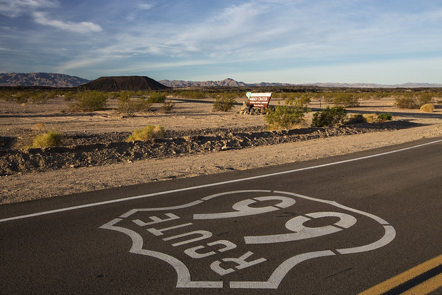
Route 66 is the boundary here between the National Preserve, run by the National Park Service, on the left, and the National Monument, run by the BLM, on the right.  Really, this is a small chunk of private property with a gas station and store just behind me. 

I did not know that Mojave Trails National Monument was here, or even existed, as I drove through on I-40, or I would have explored a bit more and taken some more photos.  The monument was too new to appear in my 2017 Rand McNally atlas that I was using for most of my navigation on this trip.  Unfortunately, it is also on the Trump Administration's chopping block, so like Bears Ears National Monument, it may have a very short life

Exploring the internet some (nowhere close to as fun as it would have been to have explored the monument itself), there are some pretty cool places here.  I'll add some links and photos from others below

From Wikipedia, Mojave Trails National Monument "was designated by President Obama on February 12, 2016 along with Castle Mountains National Monument and Sand to Snow National Monument," and "is under the control of the Bureau of Land Management."

Likewise, I knew nothing of Sand to Snow, another monument run by the BLM, or I could have probably snagged some shots from there, too. From a distance, at least. I did learn about Castle Mountains National Monument while visiting the National Park Service's Mojave National Preserve, but I did not have time to visit that one on this trip.  The Park Service manages the Castle Mountains monument, so it's safe, but Sand to Snow is on the chopping block.

Hopefully these places will still be monuments when I return.


Save the Heart of the Mojave Desert from The Wildlands Conservancy on Vimeo.

TAKE ACTION at http://www.wildlandsconservancy.org/monuments.html


Mojave Trails National Monument


From the BLM website:

The Mojave Trails National Monument is a stunning mosaic of rugged mountain ranges, ancient lava flows, and spectacular sand dunes. Protection of this area will preserve its natural, cultural and historic legacy while preserving traditional uses of the area. 
The Presidential proclamation that designated the Monument provides latitude for existing uses and activities and does not limit or prohibit rock hunting. Rockhounders are welcome to continue collecting limited amounts of rocks, minerals, and gemstones in the Monument in accordance with the Bureau of Land Management's rock collecting guidelines. 
Over the coming months, the Bureau of Land Management will be developing a management plan to help guide the uses and activities that occur in the Monument.  We are committed to an open and transparent process with the public as we move forward in developing this plan. 
https://www.blm.gov/nlcs_web/sites/ca/st/en/prog/nlcs/Mojave_Trails/recreation.html

From The Wildlands Conservancy: 
A vast array of national treasures are protected by the Mojave Trails National Monument. These treasures include:
  • A portion of California's largest cactus garden;
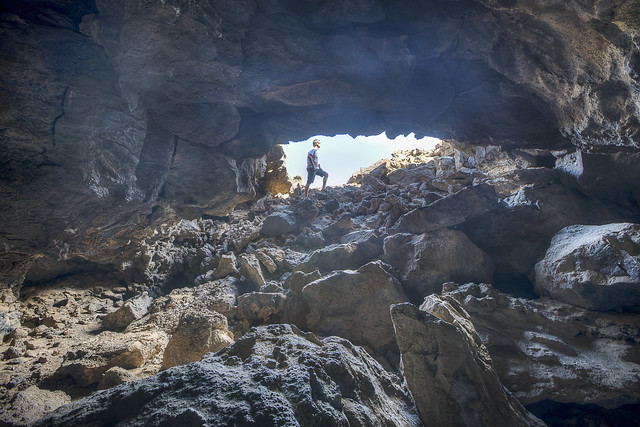
  • Pisgah Lava Flow—the most researched area in North America for the effects of volcanism on evolution;
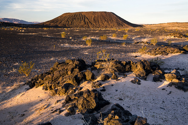
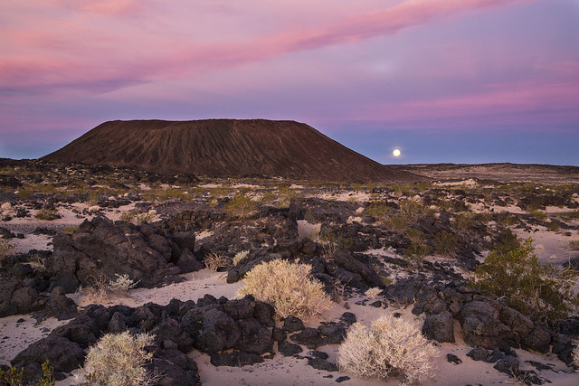
  • Amboy Crater—a National Natural Landmark;
  • Sleeping Beauty Valley—the last intact valley representing the West Mojave plant associations;
  • Cady Mountains—one of the best areas in the Mojave to see bighorn sheep;
  • Afton Canyon—the Mojave River flows year-round amid colorful canyon walls;
  • Marble Mountains Fossil Beds—site of 550 million-year-old fossils of trilobites, which were among the first animals on earth with eyes and skeletons;
  • Wildlife and recreational corridors that connect two national parks and 13 wilderness areas—a refuge for campers and explorers, bighorn sheep, desert tortoises, and fringe-toed lizards.  
http://www.wildlandsconservancy.org/conservation_mojave.html


Mojave Trails National Monument


From the BLM Website:

Spanning 1.6 million acres, more than 350,000 acres of previously congressionally-designated Wilderness, the Mojave Trails National Monument is comprised of a stunning mosaic of rugged mountain ranges, ancient lava flows, and spectacular sand dunes.

The monument will protect irreplaceable historic resources including ancient Native American trading routes, World War II-era training camps, and the longest remaining undeveloped stretch of Route 66. Additionally, the area has been a focus of study and research for decades, including geological research and ecological studies on the effects of climate change and land management practices on ecological communities and wildlife.

https://www.blm.gov/nlcs_web/sites/ca/st/en/prog/nlcs/Mojave_Trails.html

Mojave Trails National Monument


From the Los Angeles Times:

The designation was requested by U.S. Sen. Dianne Feinstein, who for a decade has sought to protect land that wasn't included in the 1994 California Desert Protection Act. That measure covered nearly 7.6 million acres, elevated Death Valley and Joshua Tree to national park status and created the Mojave National Preserve. 
Unable to gain momentum on her California Desert Conservation and Recreation Act last year, Feinstein and conservation groups asked Obama to act unilaterally to create the three monuments overlapping biological zones between roughly Palm Springs and the Nevada border. 
...  
The designations, which do not include funding, were supported by groups including the nonprofit National Parks Conservation Assn., the Sierra Club, Defenders of Wildlife, the Center for Biological Diversity and the Mojave Desert Land Trust.
Much of the land was purchased more than a decade ago by private citizens and the Wildlands Conservancy, then donated to the U.S. Bureau of Land Management in anticipation of its eventually receiving the protection of national monument status.
"This is the pinnacle of a 15-year effort to preserve the physical heart of the Mojave Desert for conservation, recreation and unparalleled inspiration," said David Myers, executive director of the Wildlands Conservancy.
http://www.latimes.com/science/la-me-monuments-20160212-story.html

CLICK on map to enlarge
https://sites.google.com/site/aaronflitt/documents/national-monuments-at-risk/BLM%20California%20MojaveTrailsNationalMonumentMap%20-%202017-06%20b.pdf

From NASA Earth Observatory:

In February 2016, the United States government established the world’s second-largest desert preserve. In designating three new national monuments in the California desert, the U.S. Department of the Interior added 1.8 million acres to an existing 7.6 million acres of protected land. This image from the Operational Land Imager (OLI) on Landsat 8 shows how they all connect. (The image [See Below] is a composite of satellite data from Landsat 8 passes on February 8 and February 17, 2016.) 
https://earthobservatory.nasa.gov/IOTD/view.php?id=87668&src=eoa-iotd

By NASANASA Earth Observatory image by Jesse Allen, using Landsat data from the U.S. Geological Survey. - http://earthobservatory.nasa.gov/IOTD/view.php?id=87668&src=eoa-iotd, Public Domain, Link

Preamble to the Presidential Proclamation Establishing Mojave Trails National Monument:

The Mojave Trails area of southern California is a stunning mosaic of rugged mountain ranges, ancient lava flows, and spectacular sand dunes.  It is a landscape defined by scarcity and shaped by travel.  The area exemplifies the remarkable ecology of the Mojave Desert, where the hearty insistence of life is scratched out from unrelenting heat and dryness.  This punishing environment has also forged the unique human history of the area, from ancient settlements uprooted by a changing climate to the armies of General George S. Patton, Jr., as they trained for battle in North Africa.  With historic American trading routes, trails followed by Spanish explorers, a transcontinental rail line, and the Nation's most famous highway, the Mojave Trails area tells the American story of exploration, migration, and commerce.  The Mojave Trails area is an invaluable treasure and will continue to serve as an irreplaceable national resource for geologists, ecologists, archaeologists, and historians for generations to come.

Pisgah Lava Flow

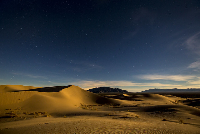
The Mojave Trails area has been a focus of geological research for decades.  This unique landscape contains a stunning diversity of lava flows, mountains, playas, sand dunes, bajadas, washes, and other features.  The area contains a number of significant sand dune features, most notably the stunning Cadiz Dunes, which have been extensively studied.  The mountains of the Mojave Trails area include several significant formations, and seismologists have studied this area for insight into faulting, tectonics, and magmatism.  A number of young volcanoes and their associated lava flows in the area have been heavily studied by volcanologists.  Amboy Crater, designated as a National Natural Landmark in 1973, has been the focus of research on a number of volcanic phenomena.  The Pisgah Volcano lava flow's vast network of lava tubes constitutes southern California's highest density of caves, and is used by both speleologists and recreational cavers.  The area's terrain and geology have provided a surrogate for lunar and Martian landscapes, and many of the robotic and imaging technologies used to better understand volcanism and Aeolian processes have been developed and tested in the Mojave Trails area.

Outstanding paleontological resources can be found throughout the Mojave Trails area.  The Cady Mountains contain important fossil fauna assemblages dating to the Miocene Period.  The Marble Mountain Fossil Bed area contains one of the classic Cambrian trilobite fossil sites in the Western United States.  Set in the green-brown lower Cambrian Latham Shale, the fossil beds also contain the fossilized remains of brachiopods, mollusks, echinoderms, and algal bodies that are of great interest to paleontologists.  The southern Bristol Mountains contain Tertiary fossils such as camel tracks, invertebrates, and numerous plants; this fossil history has also been used to understand the climate history of the Mojave Desert. Significant vertebrate fossils and other fossil resources have also been identified in Piute Valley and Cadiz Valley as well as the Ship Mountains, Little Piute Mountains, and Sacramento Mountains.

Pisgah Lava Flow

The Mojave Trails area has been important for ecological research, including studies on the effects of climate change and land management practices on ecological communities and wildlife.  It provides opportunity for further research on ecological connectivity in the Mojave Desert region, as it is among the most ecologically intact areas in southern California.  The species that have managed to thrive here are specialists in perseverance and resourcefulness and are remarkable for their ability to withstand the desert extremes.  The area's scarce springs and riparian areas such as Afton Canyon, Chuckwalla Spring, Hummingbird Spring, Barrel Spring, and Fenner Spring provide refuges for a wide variety of plants and animals.  The complex network of groundwater underlying the Mojave Trails area has been the subject of past and ongoing hydrological study. Underground aquifers feed springs and seeps that are important for sensitive ecosystems and wildlife, though specific connections are not yet well understood.

Rare plant species such as the scrub lotus, rosy two-tone beardtongue, whitemargin beardtongue, Emory's crucifixion-thorn, small-flowered androstephium, white-margined penstemon, and Borrego milkvetch rely on the specific habitat types found in the Mojave Trails area.  The Piute Valley area in the northeastern part of the Mojave Trails area is home to the northernmost occurrences of smoke trees in the California desert, as well as the Homer Mountain Ocotillo Assemblage.  The lowlands and middle elevations are also home to other unique or ecologically significant plants such as the endemic Orocopia Mountains spurge.  Numerous cactus species are also found here, including the densest concentration of Bigelow cholla cactus in California.  Ongoing research in the Mojave Trails area has identified other plant species that are new to science, many of which have not yet been described.

Cadiz Dunes Wilderness

Birds including the endangered Least Bell's vireo, southwestern willow flycatcher, and yellow-billed cuckoo depend on this area, as do raptors such as the burrowing owl, red-tailed hawk, golden eagle, American kestrel, and prairie falcon.  Fragile desert fish species such as the bonytail chub rely on the scarce waters of the desert riparian ecosystems. A wide variety of fascinating native mammal species can be found in the Mojave Trails area, including the kit fox, ringtail, American badger, mountain lion, and bighorn sheep.  Reptiles and amphibians, including the Mojave Desert's largest lizard, the chuckwalla, have been extensively studied in the Mojave Trails area.  The area contains some of the Mojave Desert's best habitat for the threatened desert tortoise and provides important dispersal corridors for that fragile species.  An unusual community of invertebrates associated with lava tubes in the Pisgah area offers an ongoing opportunity for entomological research.

Humans have lived in and moved through the Mojave Trails area for more than 10,000 years.  The archeological record tells of a human existence shaped by a changing climate.  During the Paleo-Indian period, now-dry lakes provided fresh water to small groups of nomadic people and the animals they hunted.  From around 7,000 to 2,000 BC, rising temperatures resulted in a change from wet to dry conditions.  Associated ecological changes in the region led to new patterns of subsistence for native peoples.  Although people remained closely tied to water sources following the temperature increase, desert inhabitants adjusted their diets to rely more heavily on plants and fish, invented new tools, and expanded the sizes of their social groups.  During the Formative Period (2,500 to 1,500 BC), dry conditions meant the inhabitants of the Mojave Desert remained in small groups.  They relied heavily for their survival on the Mojave River, a name derived from the traditional name for these people, Pipa Aha Macav ("the people by the river").  The Mojave people left their mark on the landscape through petroglyphs, pictographs, old trails, and stone work, some of which can still be found today, especially near springs and rivers and along the shores of now-extinct lakes.

Cadiz Wilderness

The Mojave were not the only people to use or pass through this landscape.  Ancestors of the Chemehuevi Indian Tribe, a branch of the Southern Paiute, have been persistent occupants of the Mojave Desert for thousands of years.  Sacred Chemehuevi trails are often tied to traditional and ceremonial songs.  The Salt Song Trail, one of the longest song trails of the Chemehuevi people, passes through the Mojave Trails area near the town of Fenner and the Ward Valley.  Natural land patterns form the route of this trail, with specific songs sung at specific wayside locations.  Other Native Americans who have lived in or passed through the Mojave Desert include the Shoshone, Serrano, Kawaiisu, and the Paiute.  The Ward Valley, located between the Old Woman and Piute Mountains, is sacred to a number of these tribes, as are the Mesquite and Crucero Hills, which contain over 50 archaeological sites including petroglyphs, milling stations, temporary camps, intaglios, lithic scatters, and pottery dating as far back as 4,000 years.

The Mojave Trails area has been a critical travel corridor for millennia, linking the Pacific Coast to the deserts of the southwest and beyond.  The Mojave Indian Trail is the earliest known travel route passing through the Mojave Trails area, used by Native Americans for thousands of years and by early Spanish explorers and traders.  In 1829, Mexican explorer Antonio Armijo pioneered the Old Spanish Trail through this area.  Evidence of the trail, now designated a National Historic Trail, can still be found at Afton Canyon.

By the end of the 19th century, transcontinental rail travel had changed the American West in profound ways.  In 1882, Southern Pacific constructed a railroad route from Barstow to Needles.  In addition to the major rail stops established at Needles and Barstow, several smaller towns and rail stops were established along this stretch, including the alphabetically named Amboy, Bristol, Cadiz, Danby, Essex, Fenner, and Goffs. These towns remain, some as inhabited hamlets and others as abandoned ghost towns, and some historical artifacts from the original rail line still exist, including original rail ties and track and later improvements of communications poles, insulators, and wires.

Amboy Crater - Route 66


A modest dirt road -- an original trackside component of the railroad project -- would later become the most famous highway in America.  In 1911, in the infancy of the automobile era, the County of San Bernardino paved the first stretch of that road from Barstow to Needles.  The next year, this stretch became part of the National Old Trails Road, which extended more than 3,000 miles from New York, New York, to Los Angeles, California, and connected the American coasts by pavement for the first time.  In 1926, the road was officially designated as U.S. Highway 66, a designation soon known around the world as Route 66.  During the 1930s, Route 66 became an important route for migrants escaping economic hardships of the Great Depression and droughts in the Central plains.  As the national economy rebounded following World War II, Americans took to the highways in unprecedented numbers.  The road became an American icon, earning the nickname the "Main Street of America" and inspiring popular culture through music, literature, and film.

The popularity of Route 66, however, hastened its downfall; increasing traffic quickly exceeded its two-lane capacity.  In 1985, Route 66 was officially decommissioned, leaving behind a powerful albeit fragmented narrative history of America's automobile culture of the first half of the 20th century and its legacy of related commerce and architecture.  The Mojave Trails area contains the longest remaining undeveloped stretch of Route 66, offering spectacular and serene desert vistas and a glimpse into what travelers experienced during the peak of the route's popularity in the mid-20th century.  Today, the ghost towns along this stretch of Route 66 are a visual legacy of how the automobile shaped the American landscape.

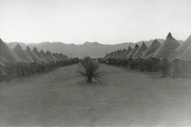
Tents at Camp Ibis, Desert Training Center Charles C. Dike, 607th Tank Destroyer Battalion

In addition to its important role in the transportation history of the United States, the Mojave Trails area is a unique resource for understanding one of the most formative periods in American military history.  During the height of World War II, the United States military recognized a need to develop a desert training program in order to prepare its troops to fight the tank armies of Nazi Germany in North Africa.  Major General George S. Patton, Jr., commander of the I Armored Corps, selected the site of the Desert Training Center in the Mojave Trails area, the largest training area in the world at the time. More than one million troops trained in the area between 1942 and 1944, including at Camp Ibis, Camp Clipper, Camp Iron Mountain, Camp Granite, and Camp Essex.  Remnants of these camps can still be found today, including rock-lined streets, staging areas, flag circles, altars, tent areas, and even tank tracks on some of the area's hardpan playas.

The protection of the Mojave Trails area will preserve its cultural, prehistoric, and historic legacy and maintain its diverse array of natural and scientific resources, ensuring that the prehistoric, historic, and scientific values of this area remain for the benefit of all Americans.

https://obamawhitehouse.archives.gov/the-press-office/2016/02/12/presidential-proclamation-establishment-mojave-trails-national-monument

Mojave Trails National Monument


BLM: Mojave Trails National Monument Map (as of June 2017) - PDF
https://sites.google.com/site/aaronflitt/documents/national-monuments-at-risk/BLM%20California%20MojaveTrailsNationalMonumentMap%20-%202017-06%20a.pdf


To comment on the monument review process (due July 10, 2017):


Video (By Others...)


Save the Heart of the Mojave Desert from The Wildlands Conservancy on Vimeo.

TAKE ACTION at http://www.wildlandsconservancy.org/monuments.html


Links


BLM:

Website:
https://www.blm.gov/nlcs_web/sites/ca/st/en/prog/nlcs/Mojave_Trails.html

Map: https://www.blm.gov/nlcs_web/sites/style/medialib/blm/ca/nlcs/mojavetrails/maps.Par.25104.File.dat/mojavetrails_20160129.pdf

flikr:
https://www.flickr.com/photos/mypubliclands/albums/72157663936032779


The White House:


Fact Sheet -- President Obama to Designate New National Monuments in the California Desert
https://obamawhitehouse.archives.gov/the-press-office/2016/02/12/fact-sheet-president-obama-designate-new-national-monuments-california


Wikipedia:
https://en.wikipedia.org/wiki/Mojave_Trails_National_Monument


The Wildlands Conservancy: 

Sand to Snow National Monument

Map (This is very cool!)

Video
https://vimeo.com/thewildlandsconservancy/mojavetrails


LA Times: Volcanic spires and Joshua trees: Obama protects 1.8 million acres in California's desert
http://www.latimes.com/science/la-me-monuments-20160212-story.html


Washington Post: With 3 new monuments, Obama creates world’s second-largest desert preserve


National Monuments in Danger:


To comment on the monument review process (due July 10, 2017):