For most of 2020, I sat out the lockdowns right across the street from this place. I've got a lot of my own content to post up eventually, but that's all down on the task list a bit... Until then, this is a pretty decent video of the old Vernonia mill, aside from where he calls a holly bush mistletoe! Ha! Fair enough, we all oops some times!

Showing posts with label video. Show all posts
Showing posts with label video. Show all posts
Tuesday, April 26, 2022


Tuesday, April 28, 2020
Saturday, September 23, 2017
Sunday, August 20, 2017
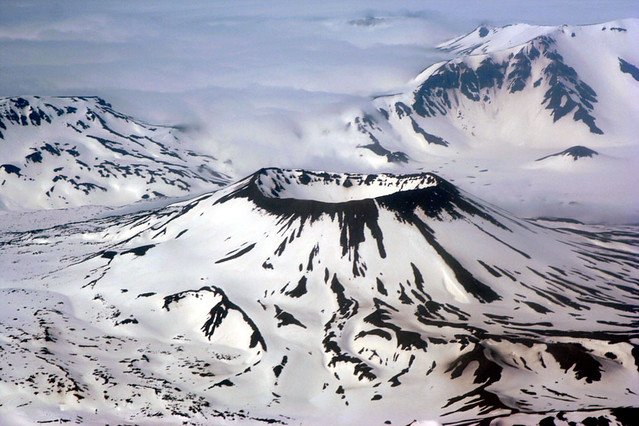
Aniakchak National Monument and Preserve: The Least Visited NPS Unit
 |
| Aerial View of Aniakchak Caldera NPS Photo |
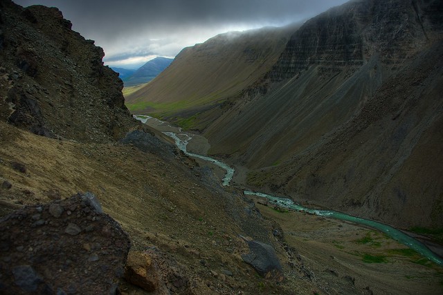
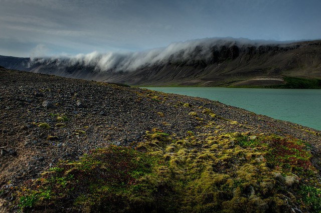
This post is a bit off the beaten path for me, and its subject is very far off the beaten path... I stumbled on this National Monument today while looking into the Alaskan monuments for my National Monuments in Danger project, and re-discovered an article I read years ago sitting in a waiting room someplace, "Baked Alaska: Surviving Aniakchak National Monument," by Christoper Solomon in Outside Magazine.
So, this place is definitely on my bucket list. However, it is the least visited unit in the National Park Service system for a reason. It is remote, it is full of bears, and I saw one mention that it is the most expensive place to visit in Alaska.
But, for a very spectacular caldera and the rafting trip out of the caldera to the ocean? Sounds amazing.
That article, and the links below, tell the story of the monument and caldera well. I'll let them speak for themselves.

By M. Williams, National Park Service - http://www.avo.alaska.edu/image_full.php?id=441, Public Domain, Link
If you appreciate posts like this, please consider becoming a monthly subscriber through Patreon!
Visit https://www.patreon.com/aflitt for more information.
Links
flickr
A spectacular Aniakchak album
https://flic.kr/s/aHsjxtAdE2
OutsideOnline
Baked Alaska: Surviving Aniakchak National Monument (April 2014)
https://www.outsideonline.com/1924416/baked-alaska-surviving-aniakchak-national-monument
National Park Service
Official Site
https://www.nps.gov/ania/index.htm
BEYOND THE MOON CRATER MYTH
A New History of the Aniakchak Landscape: A Historic Resource Study for Aniakchak National Monument and Preserve
https://www.nps.gov/parkhistory/online_books/ania/hrs/index.htm
ISOLATED PARADISE:
An Administrative History of the Katmai and Aniakchak NPS Units, Alaska
https://www.nps.gov/parkhistory/online_books/katm/adhi/index.htm
Wikipedia
Aniakchak National Monument and Preserve
https://en.wikipedia.org/wiki/Aniakchak_National_Monument_and_Preserve
Mount Aniakchak
https://en.wikipedia.org/wiki/Mount_Aniakchak
USGS
https://avo.alaska.edu/volcanoes/volcinfo.php?volcname=Aniakchak
Wednesday, August 02, 2017
"Delisted" by the NPS: Flaming Gorge National Recreation Area
 |
| Firehole Canyon Formations Firehole Canyon Campground. Flaming Gorge National Recreation Area. Wyoming. August 12, 2014 Copyright © 2017 A. F. Litt, All Rights Reserved www.aflitt.com/FlamingGorgeNRA |
National Monuments in Danger
https://sites.google.com/view/nationalmonumentsindanger/home
To comment on the marine monument and sanctuary review process
(Due August 14, 2017):
https://www.regulations.gov/document?D=NOAA-NOS-2017-0066-0001
(Due August 14, 2017):
While working on that research, I discovered some great information on 23 or 24 units, depending on the source, of the National Park Service (NPS) system that were "delisted" from 1916 through 1991. For the sake of providing additional historical context to the current debates over the 27 monuments, I will be sharing some material about these other sites over the next couple of months.
As I wrote in a post a few days ago, this is all a part of the evolution of this project. While the primary focus, for now, will remain on the 27 monuments under review, I foresee this project expanding over time to cover many different issues with our national parks, monuments, and other protected areas. Already, today, I've expanded the project website quite a bit, and more changes are on their way.
So today's post is not on one of the 27 monuments, but on a National Recreation Area. It is a former NPS site that was transferred by Congress to the U. S. Forest Service (USFS) in 1968.
Consistent with a departmental policy of reducing joint administrations, the USNPS withdrew in 1968, and the USFS administers the entire area today... The former USNPS portion, north of the Unita Mountains, is characterized by rolling sagebrush rangelands sloping gently west from the shore of the reservoir, and by more abrupt relief to the east. The picturesque Firehole Canyon is part of this area. Campground and boat launch facilities were developed by the USNPS at several sites, including Lucerne Valley on the western shore and Antelope Flat on the eastern.
-- Alen K. Hogenauer
The dam and reservoir system is managed by the Department of Reclamation, and an administrative agreement was signed on July 22, 1963 with the NPS regarding the recreational management of the lake. In this way, an article from National Parks Traveler explains, "without a Congressional mandate – there was no specific act of Congress -- Flaming Gorge National Recreation Area became a unit of the National Park System."
However, at the time, the NPS was actually trying to become less involved with the management of reservoirs, and saw this as little more than a brief "custodial arrangement not destined to last any longer than it had to." The NRA was only a part of the National Park System for five years because of this, and on October 1, 1968, Congress passed the responsibility of the NRA to the USFS' Ashley National Forest.
Other reservoirs the NPS unburdened themselves of include portions of the Shasta Lake National Recreation Area in 1948, the Shadow Mountain National Recreation Area in 1979, both of which passed to the USFS, the Lake Texoma National Recreation Area which passed to the U. S. Army Corps. of Engineers in 1949, and the Millerton Lake National Recreation Area which passed to the State of California in 1957.
In the article's comments, there is a discussion among the readers about the Park Service's management of reservoirs, and almost everyone seems to agree with the Service's approach to this here.
One reader suggested that the deciding factor should be whether or not the park offered more than just "water-based recreation," suggesting that Recreation Areas like Glen Canyon, Lake Mead, and Ross Lake (part of the North Cascades National Park Complex) all seem like good fits for the NPS because "the surrounding holdings are extensive and worthy natural and cultural resources," while Recreation Areas like Lake Roosevelt, Lake Meredith, Amistad, and Curecanti may be better run by the USFS or the Army Corps of Engineers' "excellent public recreation operation."
Another reader pointed out, "The NPS apparently very much wants to keep Curecanti NRA, and currently has a plan out for public comment that would expand Curecanti and calls on Congress to officially designate the NPS manager of the public land surrounding Curecanti's three reservoirs."
Personally, I'd hate to see Lake Roosevelt go away. That was my local park growing up and where my love of the national parks first got started.
Of course, this is all just idle musings... There is no movement I know of looking at delisting any of the National Recreation Areas.
Ultimately, though, Flaming Gorge remains a National Recreation area, it's status has not changed, just the management. It was not abolished, it just changed hands. Unfortunately, with the 27 monuments, being a part of the National Park Service system is really only a factor for Katahdin Woods, the core of Craters of the Moon, and the Parashant section of Grand Canyon-Parashant National Monument. The rest of the monuments are not facing delisting by the Park Service, they are looking at the loss of National Monument status completely.
But it is interesting to note, all of the 11 National Monuments that were abolished had their status removed by Congress. With Flaming Gorge, even just the change in management required Congressional action. This suggests that the President does not have to power to unilaterally change our monuments, though I suspect that he will try.
If he does, it may be a long slog through the courts before any of these issues are resolved.
Flaming Gorge National Recreation Area
Wyoming / Utah
Established: October 22, 1963
324 Sq. Miles
USFS / NPS (Northern Portion)
NPS Withdrawal: October 1, 1968 by Congress
USFS / NPS (Northern Portion)
NPS Withdrawal: October 1, 1968 by Congress
North Chimney Rock In Firehole Canyon (July 19, 2016)
http://rubble.blogspot.com/2016/07/north-chimney-rock-in-firehole-canyon.html
National Monuments in Danger
https://sites.google.com/view/nationalmonumentsindanger/abolished-monuments/delisted-nps-sites
To comment on the marine monument and sanctuary review process
(Due August 14, 2017):
https://www.regulations.gov/document?D=NOAA-NOS-2017-0066-0001
(Due August 14, 2017):
Video (By Others...)
Links
National Parks Traveler
Pruning the Parks: Flaming Gorge National Recreation Area Was a National Park for Just Five Years
USFS
http://www.fs.usda.gov/detail/ashley/specialplaces/?cid=stelprdb5212203
Wikipedia
Flaming Gorge NRA: https://en.wikipedia.org/wiki/Flaming_Gorge_National_Recreation_Area
Flaming Gorge Reservoir: https://en.wikipedia.org/wiki/Flaming_Gorge_Reservoir
https://utah.com/flaming-gorge
http://www.fs.usda.gov/detail/ashley/specialplaces/?cid=stelprdb5212203
Wikipedia
Flaming Gorge NRA: https://en.wikipedia.org/wiki/Flaming_Gorge_National_Recreation_Area
Flaming Gorge Reservoir: https://en.wikipedia.org/wiki/Flaming_Gorge_Reservoir
The George Wright Forum
Gone, But Not Forgotten: The Delisted Units of the U. S. National Park system (1991)
Green River, Flaming Gorge and Red Canyon: Historic 3D Photographs of Powell Survey 2nd Expedition 1871-2 (USGS)
https://3dparks.wr.usgs.gov/3Dcanyons/html/flaminggorge.htm
NPS
About "Abolished" National Mouments
https://www.nps.gov/archeology/sites/antiquities/abolished.htm
Utah.comhttps://3dparks.wr.usgs.gov/3Dcanyons/html/flaminggorge.htm
NPS
About "Abolished" National Mouments
https://www.nps.gov/archeology/sites/antiquities/abolished.htm
https://utah.com/flaming-gorge
Bears Ears National Monument: Kids Speak for Parks
 |
| Goosenecks State Park Overlook Photo: Bob Wick, BLM, August 8, 2016 CC BY 2.0 https://flic.kr/p/RF7B3F |
National Monuments in Danger
https://sites.google.com/view/nationalmonumentsindanger/home
To comment on the marine monument and sanctuary review process
(Due August 14, 2017):
https://www.regulations.gov/document?D=NOAA-NOS-2017-0066-0001
(Due August 14, 2017):
Bears Ears National Monument
2016
1,353,000 acres
BLM/USFS
27 Monuments Stop #4 (June 21, 2017)
http://rubble.blogspot.com/2017/06/bears-ears-nm-27-monuments.html
Secretary Zinke's Initial Recommendations (June 16, 2017)
http://rubble.blogspot.com/2017/06/bears-ears-national-monument-secretary.html
A Quick Tour of a Monument in Danger (June 13, 2017)
http://rubble.blogspot.com/2017/06/bears-ears-nm-quick-tour.html
Video and Links Collection (April 27, 2017)
http://rubble.blogspot.com/2017/04/bears-ears-nm-video-collection.html
Losing the Valley of the Gods? (June 13, 2017)
http://rubble.blogspot.com/2017/06/bears-ears-nm-valley-of-the-gods.html
Jacobs Chair (June 10, 2017)
http://rubble.blogspot.com/2017/06/bears-ears-nm-jacobs-chair.html
Butler Wash (June 9, 2017)
http://rubble.blogspot.com/2017/06/bears-ears-national-monument-butler-wash.html
www.aflitt.com
http://www.aflitt.com/bearsearsnm
Current Map (June 2017):
To comment on the marine monument and sanctuary review process
(Due August 14, 2017):
https://www.regulations.gov/document?D=NOAA-NOS-2017-0066-0001
(Due August 14, 2017):
Links
Kids Speak for Parks
Website
Facebook
BLM:
BLM on flickr:
Bear Ears National Monument Map (PDF - Very detailed - the best one I've found):
Bear Ears National Monument Map (PDF - Very detailed - the best one I've found):
Wikipedia:
Department of the Interior: Secretary Zinke Submits 45-Day Interim Report on Bears Ears National Monument and Extends Public Comment Period (June 12, 2017)
The Revelator: The Roots of the Antiquities Act? They’re in Bears Ears (June 15, 2017)
L. A. Times: Op-Ed Shrinking Utah's Bears Ears National Monument would be one more broken promise to Native Americans (June 19, 2017)
Monday, July 31, 2017
Canyons of the Ancients National Monument: Is it Really Safe?
 |
| Clouds and Ruins at Lowry Pueblo Canyons of the Ancients National Monument. Colorado. May 8, 2016. Copyright © 2017 A. F. Litt, All Rights Reserved http://www.aflitt.com/CanyonsOfTheAncientsNM |
National Monuments in Danger
https://sites.google.com/view/nationalmonumentsindanger/homeOn July 21, 2017, the Department of the Interior released the following statement from Secretary Ryan Zinke:
When the President and I began the monument review process we absolutely realized that not all monuments are the same and that not all monuments would require modifications. Today I’m announcing that Canyon of the Ancients National Monument review process has concluded and I am recommending no changes be made to the monument. Canyons of the Ancients is gorgeous land, but its monument status as the most high-density Native American archaeological sites in the Nation is clear. The history at this site spans thousands of years, and the federal protection of these objects and history will help us preserve this site for a thousand more years.
There is oil and gas here, which would seem to put the monument near the top of the list of 27 monuments in danger of reduction or elimination. Extraction of energy resources is one of the main motivations of the Trump Administration's monument review.
 |
| Well and Sleeping Ute Mountain Between Hovenweep and Canyons of the Ancients National Monuments. Hovenweep Road. Utah. May 8, 2016. Copyright © 2017 A. F. Litt, All Rights Reserved http://www.aflitt.com/CanyonsOfTheAncientsNM |
However, the land within this monument was already heavily leased out before its creation in 2000, and its existence does not significantly affect oil and gas production, as President Clinton's proclamation establishing the monument notes:
Because most of the Federal lands have already been leased for oil and gas, which includes carbon dioxide, and development is already occurring, the monument shall remain open to oil and gas leasing and development; provided, the Secretary of the Interior shall manage the development, subject to valid existing rights, so as not to create any new impacts that interfere with the proper care and management of the objects protected by this proclamation; and provided further, the Secretary may issue new leases only for the purpose of promoting conservation of oil and gas resources in any common reservoir now being produced under existing leases, or to protect against drainage.
https://www.blm.gov/nlcs_web/sites/style/medialib/blm/co/programs/NLCS/CanyonsNM/docs.Par.40740.File.dat/CanyonsNM-PresidentialProclam.pdf
 |
| Well and Monuments Near the ruins of Hovenweep and Canyons of the Ancients National Monuments. Hovenweep Road. Utah. May 8, 2016. Copyright © 2017 A. F. Litt, All Rights Reserved http://www.aflitt.com/CanyonsOfTheAncientsNM |
So the energy resources are being extracted from the monument already, Colorado politicians are not screaming about "federal land grabs" and wanting to sell this land for the state's own profit (like Utah... notice how the monument's western boundary is the Utah border?), and Secretary Zinke is recommending that this monument should be left alone.
All is good, right? It's saved, right?
For now.
As I've written elsewhere, I still fear that the President might just eliminate all 27 monuments regardless of the Interior Department's final recommendations. It is something he can try to do on his own, without needing that complicated support of Congress, and a decent chunk of his base would support this.
Of course, any such actions with any of the monuments will be immediately hauled into the courts, a process that might take a long time to resolve.
Alright, enough of the fear and the politics and the politics of fear... What's going on with the monument itself, right? I've been promising to write about the actual monument for a long time, and I haven't done that yet! So, let's move on to that...
 |
| One of the Canyons... Hovenweep Road. Canyons of the Ancients National Monument. Colorado. May 8, 2016.
Copyright © 2017 A. F. Litt, All Rights Reserved
|
As the BLM says:
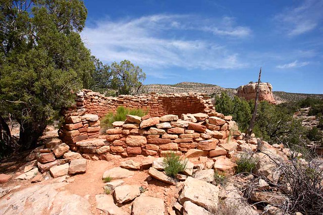
Canyons of the Ancients National Monument is a rugged and breathtaking landscape containing the highest known density of archaeological sites in the United States. The monument, covering 176,000 acres, is home to over 9,300 recorded archaeological sites including cliff dwellings, kivas and rock art.
Of course, I am sure those sites all stop at the Utah border... Except for the ones at Hovenweep... Oh, but like I said, enough of that.
While there are a few sites in the monument developed for visitor access, most of the archaeological sites are not mapped for the public and there is no developed trail system to reach them. I've actually seen it suggested, for people with desert backcountry experience, that one of the joys of this monument is to blaze out cross-country, exploring the monument on foot, and searching, respectfully, for these hidden places on one's own, though I would definately check in with rangers at Hovenweep National Monument or the staff at the Anasazi Heritage Center/Monument Headquarters before undertaking such a trip.
 |
| Great Kiva and Sleeping Ute Lowry Pueblo. Canyons of the Ancients National Monument. Colorado. May 8, 2016.
Copyright © 2017 A. F. Litt, All Rights Reserved
|
I didn't take the time to do that on my visit to the monument, and it is one of my regrets from that trip. Little was planned when I visited, and really, unfortunately, this was one where I was really just wanting to count coup while on my way to Hovenweep and Mesa Verde National Park.
In hindsight, I would have loved to have camped for a few nights at nearby Hovenweep and spent at least one day exploring these canyons more, but the day I passed through the bulk of the monument, I had few plans at all other than some basic, random wandering. I had just spent about two weeks based around Moab exploring Canyonlands and Arches National Parks (and several days dealing with some van issues) and was, for the most part, fleeing the area with little thought about what to do next.
The day before, a ranger at the Needles Visitor Center in Canyonlands mentioned that it snowed the night before at Mesa Verde, and I realized that it was relatively close, so I headed out in the morning with vague plans of driving through Canyons of the Ancients, visiting Hovenweep, and then camping for a night or two at Mesa Verde.
Of course, it was a day where I had my wander on, so I actually ended up visiting the Four Corners monument and Ship Rock in New Mexico before finally landing, late, at Mesa Verde that night and spending close to a week in the Cortez area.
 |
| Yucca and Escalante Pueblo Escalante Pueblo was constructed approximately 1120 to 1130 AD and made of groupings of stone walled family and communal rooms, including kivas. The architecture is like that of the Chaco Canyon in present-day New Mexico. The pueblo was also occupied about 1150 AD and again 1200 AD. (Wikipedia) Anasazi Heritage Center. Canyons of the Ancients National Monument. Colorado. May 9, 2016.
Copyright © 2017 A. F. Litt, All Rights Reserved
http://www.aflitt.com/CanyonsOfTheAncientsNM |
In many ways, this monument feels like an extension of Hovenweep. Hovenweep was created in 1923 to protect "six groups of Ancestral Puebloan villages." (Wikipedia) However, the area surrounding the very specific sites in Utah and Colorado protected by Hovenweep contains, as mentioned earlier, over 9,300 recorded sites with "thousands more await[ing] documentation and study." (Presidential Proclamation) These include not only old Anasazi / Ancestral Puebloan sites, but also much older sites dating back 10,000 years or more. (Presidential Proclamation). These sites gained the same protections as the Hovenweep villages when Canyons of the Ancients was created in 2000.
 |
| Dominguez Pueblo Anasazi Heritage Center. Canyons of the Ancients National Monument. Colorado. May 9, 2016.
Copyright © 2017 A. F. Litt, All Rights Reserved
http://www.aflitt.com/CanyonsOfTheAncientsNM |
Away from the main monument, near Dolores, Colorado, is the Anasazi Heritage Center, which also serves and the national monument's headquarters. There are two archaeological sites here, Dominguez Pueblo, the remains of an independent, single family settlement just next to the Heritage Center, and the larger Escalante Pueblo on the hill above the center. Out of the non-cliff dwellings, Escalante is one of the more scenic pueblos I visited on this trip, with great views of McPhee Reservoir, Sleeping Ute Mountain, and the surrounding countryside.
 |
Mc Phee Reservoir from Escalante Pueblo
Anasazi Heritage Center. Canyons of the Ancients National Monument. Colorado. May 9, 2016.
Copyright © 2017 A. F. Litt, All Rights Reserved
|
The Heritage Center itself predates the monument. It first opened to the public in 1988 and was built to preserve 3 million artifacts collected from sites in the Dolores River valley that were drowned when the Mc Phee Dam was completed in 1984.
This is a great museum on the Anasazi / Ancestral Puebloans and an essential stop in the region, superior even to the fine exhibits at near by Mesa Verde. The more recent history of the Dolores River is very interesting, as well, from Francisco Anastio Dominguez and Silvestre Valdez de Escalante's expedition in 1776, a failed attempt to find a route from Santa Fe, New Mexico to California, who the pueblos here are named after, and who themselves named the Dolores River the river of pain (or sorrow)... The river and the surrounding area lived up to its name. There is some dark history in these parts, and it is fascinating to take a look at it.
 |
| Anasazi Heritage Center and Monument Headquarters Canyons of the Ancients National Monument. Colorado. May 9, 2016.
Copyright © 2017 A. F. Litt, All Rights Reserved
|
Canyons of the Ancients is a raw and rugged place. While the huge cliff dwellings at Mesa Verde may be more spectacular, the park itself feels like Disneyland compared to this quiet place. Again, this is why I love these BLM monuments so much. Of course, a visit to the area requires time being spent at Mesa Verde, but time should also be allowed for Canyons of the Ancients and Hovenweep.
Hopefully the monument will retain its status, but even if it does not, hopefully little will change in these quiet, barely explored canyons. Go and find what you will there either way.
 |
| Entering the Monument Canyons of the Ancients National Monument. Colorado. May 8, 2016. Copyright © 2017 A. F. Litt, All Rights Reserved http://www.aflitt.com/CanyonsOfTheAncientsNM |
Denver Post: Trump review turns focus to quiet, historic Canyons of the Ancients monument in southwest Colorado - Research shows rural counties across the West with more federal lands do better (July 21, 2017)
http://www.denverpost.com/2017/04/26/canyons-of-the-ancients-colorado-trump-monument-review
...Canyons of the Ancients is a big tourism draw for the Four Corners region, which includes Mesa Verde National Park.
“This monument is pivotal to our visitor experience,” said Kelly Kirkpatrick, the head of the Mesa Verde Country Visitor Bureau. “The monument is a huge part of the overall story of the Ancestral Puebloans, and we rely heavily on its importance to our tourism economy.”
Canyons of the Ancients
2000
175,160 acres
BLM
https://sites.google.com/view/nationalmonumentsindanger/the-27-monuments/canyons-of-the-ancients
27 Monuments Stop #3 (June 19, 2017)
http://rubble.blogspot.com/2017/06/canyons-of-ancients-nm-27-monuments.html
Sleeping Ute Mountain from Lowry Pueblo (September 23, 2016) www.aflitt.com
http://rubble.blogspot.com/2016/09/sleeping-ute-mountain-from-lowry-pueblo.html
www.aflitt.com
http://www.aflitt.com/CanyonsOfTheAncientsNM
BLM: Canyons of the Ancients National Monument Map (as of June 2017) - PDF
Links
U. S. Department of the Interior
Monument Review: Secretary Zinke Recommends No Modifications to Canyons of the Ancients (July 21, 2017)
https://www.doi.gov/pressreleases/monument-review-secretary-zinke-recommends-no-modifications-canyons-ancients
BLM
Website
https://www.blm.gov/nlcs_web/sites/co/st/en/BLM_Programs/NLCS/CanyonsNM.html
https://www.blm.gov/programs/national-conservation-lands/colorado/canyons-of-the-ancients
Anasazi Heritage Center
https://www.blm.gov/learn/interpretive-centers/anasazi-heritage-center
Map
https://www.blm.gov/nlcs_web/sites/style/medialib/blm/co/programs/NLCS/CanyonsNM/maps.Par.55277.File.dat/CANM_map.pdf
flickr
https://www.flickr.com/photos/blmcolorado/albums/72157664342704112
https://www.facebook.com/BLMCanyonsoftheAncients
National Park Service
The River of Sorrows: The History of the Lower Dolores River Valley
https://www.nps.gov/parkhistory/online_books/rmr/river_of_sorrows/contents.htm
Yucca House National Monument Visitor Guide
https://www.nps.gov/yuho/learn/historyculture/upload/yuhositebulletin.pdf
Yucca House National Monument Website
https://www.nps.gov/yuho/index.htm
History Colorado: Dolores County
http://www.historycolorado.org/content/dolores-county
The Durango Herald: Fifty years of McPhee
https://durangoherald.com/articles/31763
Presidential Proclamation Establishing Canyons of the Ancients National Monument
https://www.blm.gov/nlcs_web/sites/style/medialib/blm/co/programs/NLCS/CanyonsNM/docs.Par.40740.File.dat/CanyonsNM-PresidentialProclam.pdf
Recreation.gov: Canyons of the Ancients National Monument
https://www.recreation.gov/recreationalAreaDetails.do?contractCode=NRSO&recAreaId=3114
https://www.instagram.com/explore/locations/244728219/canyons-of-the-ancients-national-monument
Wikipedia
Canyons of the Ancients National Monument
https://en.wikipedia.org/wiki/Canyons_of_the_Ancients_National_Monument
Lowry Pueblo
https://en.wikipedia.org/wiki/Lowry_Pueblo
Anasazi Heritage Center
https://en.wikipedia.org/wiki/Anasazi_Heritage_Center
The Conservation Fund: Canyons of the Ancients National Monument
Over the years we’ve helped the monument protect more than 8,700 acres within its boundaries, including both the largest and the most critical private inholdings containing Jackson’s Castle (first photographed by William Henry Jackson in 1874) and the Skywatcher Site, a 1,000-year old Ancestral Puebloan solstice marker.
http://www.conservationfund.org/projects/canyons-of-the-ancients-national-monument
Crow Canyon Archaeological Center: The Archaeology of Sand Canyon Pueblo
The Archaeology of Sand Canyon Pueblo: Intensive Excavations at a Late-Thirteenth-Century Village in Southwestern Colorado is one in a series of online site reports published by the Crow Canyon Archaeological Center. Like other publications in the series, this report consists primarily of interpretive summaries organized into separate chapters, by topic. Although summary data are reported in both tabular and graphic form to support the conclusions presented in text, the emphasis in this publication is on interpretation and synthesis, not on the reporting of basic data.
Contents
https://www.crowcanyon.org/researchreports/sandcanyon/text/scpw_contentsvolume.asp
Human Skeletal Remains
https://www.crowcanyon.org/researchreports/sandcanyon/text/scpw_humanskeletalremains.asp
National Monuments in Danger
Subscribe to:
Posts (Atom)