
Drove around the Big Lava Bed today and we were wondering about lava tube caves in the area…

Of course, there is Ape Cave, but that is a bit further away. Really, I want to know if any have been found associated with the Big Lava Bed flow itself… We did see a nice caved in tube, but didn’t poke around long enough to find a cave, though it would be surprising if there were not a ton of them.
Lists, links etc. to Trout Lake and Falls Creek caves…
Update September 29, 2012: Found a link to a pdf of Caves of Washington by William R. Halliday:
https://www.box.com/shared/syg47zjgqu#/s/syg47zjgqu/1/24749920/260009824/1
Trout Lake Caves - Oregon Grotto of the NSS:
Some links to Trout Lake caves. http://www.goodearthgraphics.com/showcave/wa.html
This area has hundreds of lava caves. There are large caves with 60 foot high ceilings (Cheese cave) to belly crawling caves. Too many of them to name. There are maze like caves like Deadhorse cave, Pickings cave and more. There are Ice caves (Gular Ice cave). Caves with cool formations, lava trenches (Wildcat cave), Natural Bridges and more. Then there are big long caves with lots of breakdown to give you a good work out like Big cave. Then there are caves with cool minerals in them like Happy cave, Slime cave and Metrocal cave.
Indian Heaven Volcanic Field, Washington
http://vulcan.wr.usgs.gov/Glossary/LavaTubes/description_lava_tubes.html
From: Wood and Kienle, (eds.), 1990, Volcanoes of North America - United States and Canada: Cambridge University Press, Contribution by Paul E. Hammond
- The Indian Heaven volcanic field is midway between Mount St. Helens and Mount Adams ... Basalt to mafic andesite lava flows range from 0.4 to 24 meters in thickness, whereas andesite flows are up to 90 meters thick. Individual flows extend up to 46 kilometers in length, have areas to 116 square kilometers, and volumes to 1.2 cubic kilometers. Most flows less than 150,000 years of age contain extensive lava tubes, making the Indian Heaven Volcanic Field and important speleological area.
From: Swanson, Cameron, Evarts, Pringle, and Vance, 1989, IGC Field Trip T106: Cenozoic Volcanism in the Cascade Range and Columbia Plateau, Southern Washington and Northernmost Oregon: American Geophysical Union Field Trip Guidebook T106.
- The Indian Heaven volcanic field, midway between Mount St. Helens and Mount Adams, is a Quaternary center, chiefly of basalt. ... About 60 eruptive centers lie on the 30-kilometer-long, N10degreesEast-trending, Indian Heaven fissure zone. The 600 square kilometer field has a volume of about 100 cubic kilometers and forms the western part of a 2000-square-kilometer Quaternary basalt field in the southern Washington Cascades ... Pahoehoe and a'a typify the basalt flows; some of the andesite is block lava. Tephra production was minimal, although the basaltic tephra accompanying extrusion of the Big Lava Bed flow has a volume of about 100,000 cubic meters. Big Lava Bed is known for its tubes and for the remarkable microtopography on its surface, which mostly results from inflation of the flow when its feeder tubes clogged.
Falls Creek Cave
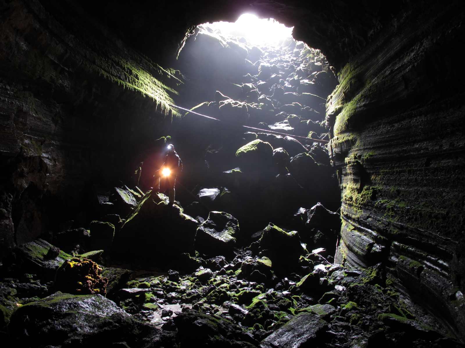
Falls Creek Cave entrance photo from Curious Gorge Blog.
#59 Falls Creek Cave « Curious Gorge Blog:
Bring lights, have fun!! Falls Creek Cave is one of a number of “hidden” caves in the Gifford Pinchot forest, but unlike many, Falls Creek cave is reasonably easy to explore with technical caving gear, nor the need to crawl. Not many lava tubes allow you to make an underground loop like in Falls Creek cave. Gotta like that!!
del greening Says:
May 14, 2012 at 2:43 pm | Replyseveral years ago ,,in a book ( i think ” caves of washington state”) there was a ‘surveyed’ map of the falls creek cave… it is humungus the entrance was listed as having an elevetion of up to sixty feet. the map showed the twists and turns clear to the terminus…very detailed. i have made many trips thru with scouts. a great trip and further east are great places to rough camp near the creek. one thing to remember if you go,,, back in a ways there is a drop of maybe six to ten feet, it dse not hurt to carry a length of rope to tie off above and use as a safety line in passing either up of down,,….
Falls Creek Cave : Trailpedia:
Directions: I-84 East from Portland: 1. Travel east on I-84. 2. Take Exit 44 for Cascade Locks. 3. Take an immediate right after the off-ramp. You will wind around a short on-ramp for Bridge of the Gods. 4. Cross Bridge of the Gods (NOTE: There is a toll). 5. Turn right onto Highway 14 East. You will follow the road through Stevenson, past a pond and toward Carson. 6. Turn left onto Wind River Road (milepost 47.5). 7. Go straight through the four-way stop in Carson to remain on Wind River Road. 8. Turn right onto the second Old State Road (milepost 5). 9. Take the first left onto Panther Creek Road (FS Road 65). You will cross Panther Creek in 4 miles, and pass a quarry in 7.3 miles. 10. Go straight through the “4 Corners” junction (10.8 miles in) to remain on FS 65. 11. Turn left onto FS 67 about 2 miles later; the pavement ends here. 12. Stay right at the fork for FS 6701 in 0.8 miles. 13. Continue 0.8 miles farther past a campground and quarry. 14. Turn right at the sign for Falls Creek Trail 152. There is a small, dead-end set of tire tracks just off the main road that is a good place to park.
http://www.oregongrotto.com/troutlake.shtml
Falls Creek: 633-204. About 6000 total feet with about 4300 feet in the main pain passage. There are three parts of the cave separated by collapse sinks. (AKA: Panther Creek, Lava Caves). See Caves of Washington for full write up.
Salamander Cave
Salamander - lower entrance photo (http://www.oregongrotto.com/gallery/v/washcaves/Falls-Creek/Salamander_Quick_e_mail_view.jpg.html)
No idea where this is but it is near Falls Creek, apparently. Maybe a part of the same tube system?

Salamander: 633-201
Double Eagle Cave
Again, I have no idea where this is but it is near Falls Creek, apparently. Maybe a part of the same tube system?
But I will say, I don’t like the looks of this… The caption is “dug open entrance.”

Apparently, it opens up a bit on the inside…

Photos from http://www.oregongrotto.com/gallery/main.php?g2_itemId=2308
Double Eagle: 633-200: A tight vertical entrance into a nice little cave. Mostly walking.
Skamaniac / Datus Perry

Photo from http://www.oregongrotto.com/gallery/main.php?g2_itemId=2308
Skamaniac: 633-205 See Datus Perry cave.
Datus Perrys Cave:…part of the Falls Creek Lava Tube System, was reported to Oregon Grotto in early 1968 by Datus Perry, a long-time resident and inveterate cave digger of Carson Washington. Best known for its lava stalactites and stalagmites, parts of the cave were photographed by Charlie and Jo Larson on May 19, 1968. Two photos depicting a two-foot lava stalagmite "before and after being broken," included in the 1980 Oregon Grotto Slide Show, were actually photos of the stalagmite as found (broken) and of it reassembled. In 1975, Oregon Grotto members surveyed 800 feet of the cave before the survey was abandoned because the cave was too cold for "shirt sleeves." Speleograph trip report by Libby Nieland Vol. 11 page 129. And Underground Express by bill Holmes 18 (3): 27.
Mrs. Olson’s Extension

Photo from http://www.oregongrotto.com/gallery/v/washcaves/Falls-Creek/
Olsen Cave


Photos from http://www.oregongrotto.com/gallery/v/washcaves/Falls-Creek/olsencave/
Three Sinks Cave

Photo from http://www.oregongrotto.com/gallery/v/washcaves/Falls-Creek/3sinks/
Three Sinks: At 2,800 feet map length, Three Sinks Cave is the second longest know segment of the Falls Creek Lava Tube System. Cavers learned of the cave from an Oct., 1967, letter from Clay Beal, then a U.S.F.S. Disrtict Ranger, to Bill Halliday which was forwarded to Oregon Grotto. First known cavers to
visit the cave were Charlie and Jo Larson who found it to be a world class example of stream flow, sedimentation and subsequent erosion of pyroclastics in a lava tube. Oregon Grotto held a Forest Service special use permit for several years; currently the cave enjoys special protection by the Forest Service. Trip report Speleograph 359 page 8.
Folgers Cave:
633-213: A segment of the Falls Creek Lava Tube System, named after a Folgers Coffee can found nearby, was first entered in March, 1968, by an Oregon Grotto party. A 1973 map by Rick Pope and Rick Lonergan shows about 2,100 ft (950 ft map length) of moderately sinuous underlain by terminal branches. Mostly breakdown, the cave exhibits some fascinating lava balls and sand castles. Trip report Speleograph 359 page 8.
Blister:
633-203 Falls Creek area cave.
Breakdown Mountain Cave
The cave is named for the prominet breakdown mountains in the cave. The small entrance sink, 8 foot deep, leads through a low opening (4 feet high) to a more spacious cave with 15-25 foot ceilings. Also known as "Lower Falls Creek System" with about 200 feet of passage at 2570 elevation.
Downdraft Cave
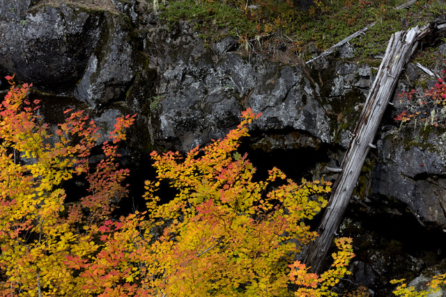
Near the Big Lava Beds. A very nice cave.
Big Crater caves
AKA The Dog Caves. Goose Lake. Story Cascade Caver Sept. 2010 Vol. 49 #4 Page 5-6 with map.
Cave Creek Road System:
See story in Speleograph 380 Page 12.
Dead Horse Cave, Trout Lake
Dead Horse Cave is no ordinary lava tube cave. It is the most complex, mapped, lava tube cave in the U.S.--so complex that the generic term “lava tube” seems inappropriate. A very popular cave, broadly consisting of the River Passage, Lower Cave, and Masochists Maze, the cave has three known entrances: the lower entrance (which floods occasionally), the upper entrance (also known as the Rat Hole), and a dug entrance near the northeast corner of Masochists Maze (repeatedly dug open and later backfilled, present condition unknown).
Well known to locals for decades, as with many other caves in the Trout Lake area, cavers were led to the lower entrance of Dead Horse Cave on Nov.5, 1965, by Lyle Ryan, a Trout Lake resident and employee of SDS Lumber Co. The upper entrance was accidentally found by Don and Maylin Nelson who visited the cave with an Oregon Grotto group on Oct.26, 1969. The opening was confirmed as an entrance by Bob Baker, the first person to enter the cave via this opening.
This cave lies in the path of ground water moving downslope obliquely toward Dead Horse Creek, which it parallels to the north. Water, manifested by pools, broken streams, subterranean fracture springs (and one boiling spring) streams through parts of the cave; then sinks back into the open rock or sediments, and eventually finds its way to the bed of Dead Horse Creek about 400 feet below the cave's lower entrance.
It was four years after learning of the cave's existence before cavers--expecting to map a deserving but small cave--got around to Dead Horse. An Oregon Grotto team began mapping Oct.19, 1969, and was repeatedly amazed by what lay beyond the "small" cave. It just kept on going and going. The lower maze area was not mapped until Oct. 10, 1971. The last major mapping, Mar. 9-10, 1991, logged about 4,500 feet of passage in Masochist Maze (Larson, 2005)
Dynamited Cave, Trout Lake

http://www.oregongrotto.com/gallery/v/washcaves/Dynamited_Cave_Oct_1970.jpg.html
When I was starting my caving, back in the Pleistocene as I recall, there
was a report that the sinkhole where the Dynamited entrance is, held a
strange and wonderful lava tube, one with vertical drops in it. This was
before I started the OG and well before the WVG. Early 60's I was in
contact with Cascade G via Halliday and was an Oregon chapter of his Western
Speleological Survey.
The story was, that kids from Troutlake or Stevenson had gone in there,
roped down a pit and when they dropped off the stretchy rope (there was no
"caving" rope back then, and everything stretched hugely under body wt) it
twanged back, well out of reach. Seems hard to believe, as more than one
had to do it, but who knows. They were trapped. To get out, they piled
up a mound of rocks and one was able to grab the rope and climb out
(probably hand over hand, explaining why they all couldn't do it--much harder than
folks think). That kid went for help and the parents came and got the
rest out. They saw the cave as hazardous, and being loggers, had access to
dynamite. So they mined the entrance and brought it down.
Halliday announced he was getting up an effort to open that legendary
cave, and so I headed up there with a couple of my Reed buddies. Bill had a
comealong and we stressed that out pretty good and managed to pull a few
rocks out of the pile, one time the harness slipped off and the weighted cable
came snapping back with great force, narrowly missing us.
That got us a hole you could squeeze decent sized humans thru and we were
in. Sure enough, the legend was true. Pretty amazing to us, back then.
And the rock pile was there to see.
We once, as we were exiting, met some locals coming in to do the
cave....when we said there were vertical drops, one, carrying a gunnysack showed us
what he had in it....a long rope ladder made of hemp rope, and some
"pitons", which were in fact railroad spikes.
When the first gate was put on the cave, it was just an expanding bar/tube
in the squeeze hole. That didn't last long as the locals apparently
didn't like the idea of applying to Seattle for access. I presume someone
drove their log truck tractor up there, ran a log cable from the road to the
gate, and drove away with the gate....leaving a hole you could then walk
thru.
Stevehttp://www.oregongrotto.com/cavehistory.shtml
Dynamited Cave: 633-50: One of the longest caves in the Trout Lake area with many vertical drops and levels. 12,345 feet. Dynamited Cave was discovered in Spring, 1958, by Reno and Carl Ziegler, loggers with the Broughton Lumber Co. In Oct., 1958, early exploration began when Carl Nielsen, family members and friends entered the cave as far as the 15-ft drop. Sometime between Oct. 18 and Dec. 6, 1958, the most decisive event in this cave's history occurred when--after five local boys were unable to ascend a 40-ft pit they had dropped on a 3/8-inch rope--the entrance was dynamited, ending exploration of the cave until 1961. Dynamite was employed again in late 1972 to destroy one of a series of typically impotent gates, this one some distance inside the cave.
This widely popular cave is the most mapped cave in the Trout Lake area. Only moderately sinuous in plan view, it is highly complex in profile, having widely varying mutiple levels and abrupt drops.
Guler / Trout Lake Ice Cave
#72 Ice Cave Trout Lake « Curious Gorge Blog:
The Trout Lake Ice Cave was known historically as the Guler Ice Cave. There are other caves in the area, but most of them are on private property, such as the “Cheese cave”. The Trout Lake Ice Cave is one-of-a-kind in terms of ice formations. Make a special late-April/early May trip to the Ice cave and you will be blown away!!

2 comments:
I have a snapshot probably from the 30s of my two great uncles standing on rocks near the entrance to a big hole. On the back is written “Fred and Plez at the horse Cave. 7 miles underground.” The family is from Oakesdale Washington. I wonder if this is the same cave. I’m very happy to email or text the picture.
I have a snapshot probably from the 30s of my two great uncles standing on rocks near the entrance to a big hole. On the back is written “Fred and Plez at the horse Cave. 7 miles underground.” The family is from Oakesdale Washington. I wonder if this is the same cave. I’m very happy to email or text the picture.
Post a Comment